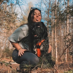
Great hikes so bunch of mushrooms. Kita heard her knee and got a bug in her eye and we went down to the lake and had ice cream.
★
★
★
★
★

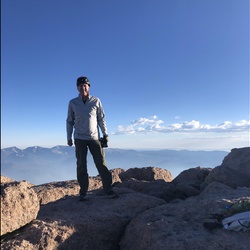
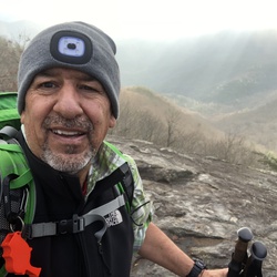
Nice time of the year to hike. Now that the leaves have fallen, you get to see the “hidden views”. It was a beast of a climb from Blue Ridge Gap on the way back. Keep some electrolytes handy and carry 2-3 liters of water.
BTW, Gaia seems to underestimate the elevation gain. All Trails logged it as 4,540 feet and Garmin at 4,940 while Gaia was 3,714. I would go with Garmin after the way I felt after getting back to the parking lot.
Have fun out there!
★
★
★
★
★

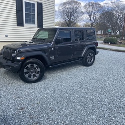
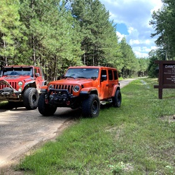
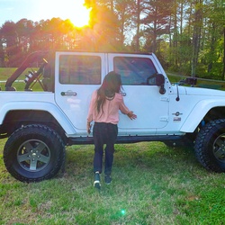
Really disappointed that I couldn’t get to the cemetery on this trail ride, but the weather after morning rain and storms was perfect in 100°F+ summer heat indexes. Water came up to the rock rails on my Jeep Rubicon. No issues with intrusion. Trail seems to be getting built up with new cabins, so it’s unclear how long this trail will be open to responsible 4x4’ers.
★
★
★
★

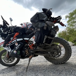
6-2-2024: We came in from Lake Winfield Scott on FSR 33, then north on FSR 33A. Up to this point is was an easy FSR, then came the climb up to Duncan Ridge Road. It was a cliffside rocky crawl most of the way. Was it difficult, not for a Bronco Sasquatch in 4 high. Was it technical, yeah, unless you like driving off high cliffs.
Now with that said, it was really an adventure because it was pouring down rain socked in with clouds and fog. We didn't see much, but it was an adventure.
We'll be back!
★
★
★
★
★

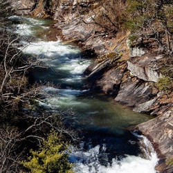
Very easy hike to the falls. Loved hiking along the creek and learning it flows 550 miles to the Gulf of Mexico. Well shaded due to the trees surrounding the path.
★
★
★
★


Remote but the roads were in good condition. A lot of primitive camping options
★
★
★
A great day to hike. Perfect temperature and clear skies. It was great to talk to many through hikers. JustUs creek was in full flow. Not a difficult hike.
★
★
★
★
★

Good short hike to the ridge and back. Jody over 2 miles with 500ft elevation gain.
★
★
★
★

Best big loop trail ride! Northern section gets tight but very fun!
★
★
★
★
★

Small creek to rock hop.Otherwise mostly gradual ascent then0.3 mile down hill to river not heavily traveled but well maintained
★
★
★
★

We enjoyed the beautiful hike even though the falls didn’t have much water. The path was mostly fine, with some slippery spots. Parking might be a problem, unless you have a high clearance vehicle.
★
★
★
★

Well kept trail , hardest part is first mile going up , beautiful scenery to both sides of ridge then the relaxing bed creek watching the bridge , then up again but more gradual, finishing downhill:-)
★
★
★
★


Trail is in very bad condition. Lots of downed trees. You will not be able to do the loop. Grasses are tall and loaded with ticks. This used to be well maintained. Sad to see it in such bad shape.
★
★

Downhill on the way out. Uphill back. Falls excellent. Mostly peaceful. Not a lot of people on the trail.
★
★
★
★
★

Great hike. The entire trail was along the creek with multiple waterfalls. Several campsites along the trail for those who was to bring gear.
★
★
★
★
★

Steep but easy trail to hike. .6 miles. There is a shuttle to the top of you are unable to walk
★
★
★
★

John’s Mtn loop is a nice way to extend the hike beyond Keown Falls. Relaxing hike.
★
★
★
★
★


Good trail with some decent elevation. Lots of debris from recent storms and a few blowdowns but not an issue
★
★
★
★
★

This trail is great for sight seeing, we saw chipmunks, hawks, bees. Great waterfall at the very top. Good intermediate hike.
★
★
★
★
★
Great hike and gets your blood pumping. A few uphills but very manageable. Rained on our return about 2 miles from the end making for some slippery places but rain was light and it was still warm
Highly recommend this trail
★
★
★
★
★

Perfect time of year. cool, crisp and sunny. Most of the leaves have fallen but there was a beautiful array of colors on the trail.
★
★
★
★
★

Woke up this morning at the 3rd campsite from the trailhead. We are a party of five. Hiked today to a campsite closest to the waterfall. Checked out the falls and it’s gorgeous. Reminds me of some steep climbs I’ve done at Sunset Rock at Lookout Mountain and Anna Ruby Falls. Very similar to the AT which is just a stone’s throw from us (Hogpen Gap). More day hikers than I’d like and most people have dogs. The autumn leaves are starting to make a glorious appearance.
★
★
★
★
★
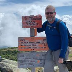
Really short hike if you’re in the area - You can check-off another 4K+ peak in Georgia. Not much views in early Fall. Maybe late Fall or early winter maybe better times for views
★
★
★
★
★
Yet another 4K+ elevation peak in Georgia. Some bushwhacking required to get to top of Cowpen as there’s no trail. Same with Panther Bluff.
★
★
★
★
★

Challenging hike. 15 or so water crossings on the west side of the loop following the river the majority of the way. More gradual slope trails on the east side with little to no water.
★
★
★
★
★
Hard hike. We parked at Dick’s creek gap and took a shuttle to Tray Gap. Don’t plan on hiking this in 80+ weather. Don’t miss to see the unmarked vista point about 0.25 miles from Tray Mountain peak; a short detour behind the small camp site on the right side of the trail. This is before you hit Tray Mountain Shelter.
★
★
★
★
★

Good first time on traverse. Woke up to rain with no rain fly on hammocks. Overall fun
★
★
★
★
★
Initial climb up to Blood Mountain is a beast - Rocky. Rest of the way is quite decent
★
★
★
★
★
Trail up to the falls is finally opened. Very popular hiking trail. There are still lots of places where the original trail has been washed out. Be prepared to get your feet wet. Also, do look for alternate paths that are there to make stream crossings more manageable - especially if you have children in the group
★
★
★
★
★

Did this route in a clockwise fashion last august. First day was filled with steep inclination, camp was set up around 4 miles in. Day two was easy with most of the trail being a gradual decline. The Inn was a welcome experience with a great overlook, friendly people, and hot coffee. The hike back to the falls was quick from there and included a couple of pretty outlooks.
★
★
★
★
★


An easy hike. Great ending. A pool to get wet in and great rocks to sit and enjoy the sounds of the waterfall. Nice cool area to beat the heat.
★
★
★
★
Great day to hike. Nice and warm - Not hot.
Do go down to see the origins of Chattahoochee River - Origins of any mighty river gives one pause for thought.
★
★
★
★
★

Always a great hike, almost totally shaded from the thick canopy and rhododendron tunnel.
★
★
★
★
★
Always a good hike with enough challenges to give a good workout. Met a few AT thru hikers on Springer getting a late start. Great views and trail is in good condition
★
★
★
★
★

Amazing trail. Bushwhacked the entire 18-19 miles. About 100 blowdowns. Wear pants and long sleeves. Prepare to get wet. The falls are amazing.
★
★
★
★
★
Great early spring day for the hike. Gorgeous weather. Rains were in the forecast but did not matery
★
★
★
★
★

Amazing trail. Not too hard after you test your balance on a tree crossing at about .3 miles in. The trail follows the stream all the way up with multiple smaller falls along the 2.8 miles out. Make sure you finish, the falls at the top are beautiful.
★
★
★
★


Went up across the mountain to Blue Ridge and ate at the Taccoe River Fish House and then travel back up toward Suches through the mountains at home great day!
★
★
★
★

Tray Mountain Road is a nice easy ride in the north Georgia Mountains. No significant obstacles. You need clearance, but if it’s dry you won’t need 4x4
★
★
★
★
Great hike, I recommend taking the trail clockwise to get the elevation at the beginning of the hike. Moderate is a fair description with lots of roots and rocks. Very enjoyable.
★
★
★
★
★

Great hike with my daughter Daisy. Challenging pitch but easy trail to follow. Averaged good pace.
★
★
★
★


10/24/21 - great trip, camped just below Coosa summit , nice clean camp site, water available. Hacked counter clockwise, 14.6 miles total trip using GAIA GPS.
★
★
★
★
★

Good hike with some nice overlooks to stop and admire. Clear enough to see Stone Mountain and Atlanta this day. Roughly 7 miles to camp spot just past Hogpen Gap. Day started out cold (low 40’s?) and windy but warmed up by 10-11am and wind subsided. Spring less than 50yds before rd crossing. Campsite past Hogpen Gap sits on ridge so somewhat exposed to a north/westerly wind-temps dropped below freezing that night and wind had to be near or in excess of 30mph. Did not make for a restful night. Dependent upon weather, one should consider pushing on to Low Gap.
★
★
★
★

Not a bad hike, after Smoky mountains may seem underwhelming, but still has all the basic attributes of a pleasant hike. Was crowded on a nice fall Saturday.
★
★
★

Easy hike with beautiful southern views! Nice outcrop to sit and contemplate life. Can be crowded at the summit!
★
★
★
★
★
Easy hike with beautiful southern views! Nice outcrop to sit and contemplate life. Can be crowded at the summit!
★
★
★
★
★

Note I forgot to turn on the recorder on the way out to the upper Falls. Otherwise short but nice hike. On the weekend can be busy get there early
★
★
★
★

Good parking along Noontootla creek on FS-58. It’s the AT and Benton McKaye so it was of course well-maintained. Good 4-5 hour trip if you stop for lunch at the top.
★
★
★
★

This was a fun trail that leads to a great kayak/canoe ramp with easy steps into the water and a wonderful swimming/fishing spot later down the trail. Not technically challenging but if there is a lot of rain it might be slick in spots.
★
★
★
★

This was a very easy trail. Great to take you pet for a walk on. The observation deck is outstanding. Providing a great place to eat a snack, take some pictures, etc. I would recommend this to anyone for a breath of fresh air and beautiful scenery.
★
★
★
★


This is a nice ride in the North Georgia mountains. Not much of a view in the summer, but it looks like a great place for fall/winter views. There are a few water/mud crossings and the hike to High Shoals falls is very nice. Take plenty of water if you do the hike, the return trip is all uphill.
★
★
★
★
★

This was an easy to navigate hike with incredible views of the falls. The stairs can challenge some but there are plenty of landings with rear areas along the way.
★
★
★
★
★

The hike was a challenge going down steep downhill into Panther Creek Falls. Camped at the top of the falls near the creek. The hike out was wet. Lucy woke me up to say the lightning and thunder was coming. We were packed and had just put my pack on for the walk back. Drenched in 1 minute and the trail was a river. Not even close to death! Just the way we like it.
★
★
★
Great hike from lake to intersection with the AT. 4 miles from parking lot to the top. Lots of rocks and roots with a steady incline.
★
★
★
★
★

Great moderate forest road to a great hike on the AT!
★
★
★
★
★

Fairly easy trail. Not much to see. Lots of overgrowth for pinstriping! Lots of fallen trees along the area, but mostly cleared trail way. Puddles were not deep at all - did not need 4wd.
★
★

As of 03/18/2021, this trail is still closed due to debris and washed out trails. DOF stated anyone caught on this trail is subject to trespass and/or fines. My family will try again next year to hike it.
★
★
★
★
★


I loved The Appalachian Trail!
This was my first real section hike and definitely some of the best views I’ve ever seen.
The weather was great. The highs during the day were in the mid to upper 50s, but the nights were a bit chilly. A couple of nights got down in the mid 30s. We weren’t exactly prepared for the low temps at night, but we managed.
We carried too much weight in our packs (nearly 40lbs when we started the trail at Springer Mountain).
We are planning to complete the Georgia section (Neels Gap to the NC border) of The AT in the fall of 2021.
★
★
★
★
★
Great trail! Gravel road was well maintained! The side trails were way more technical and a lot of fun. High clearance vehicle is suggested
★
★
★
★


Did a good ride with Steve and Chuck. For the most part it was not a difficult ride. Fell twice on the leaves but that was about it. Could do this ride solo.
★
★
★
★
Favorite Warwoman trail. Made it with a stock wrangler JL with 32” terra grapplers G2.
★
★
★
★
★
Past the Gilmer County line from Nimblewill Gap trail it gets very rocky & you need to pay attention to your chosen line in some parts so you don’t hang up due to ground clearance. Awesome trail though!
★
★
★
★
★
Combines the AT and BMT with great scenery and well maintained trails. Not too difficult but a good workout.
★
★
★
★
★

This is a good hike for folks who want an easy treadway, modest climbs, few encounters with others, and traversing isolated terrain.
★
★
★

Beautiful hike. Quite a challenge for someone new to hiking and lacking proper equipment. I made it and I absolutely would do it again. There was a lot of ice which added to the beauty and to the challenge. Some of the elevation climbs are steep and sudden which can take the wind right out of you. Take your time, enjoy the beauty surrounding you, and breathe. You can do it!
★
★
★
★
★

Tough hike today climbing over 2700 ft. Awesome views, best now during the winter. Brasstown Bald gift shop was closed. I met a total of 6 people on the trail, all while I was going in. I had the entire to myself on the way back out.
★
★
★
★
★

Very cold day. 22 degrees when I left . Great hike. Some steep climbs. Met a thru hiker.
★
★
★
★
★
Great hike at amichola state park. 450 steps up the AT approach trail then 5 miles on AT approach to len Foote inn. Approach trail is challenging rated hard. But well worth it
★
★
★
★
★

Did this the day after Thanksgiving and there was lots of people doing this hike. Not sure who makes the biggest mess the humans or there dogs. Leave no trace!
★
★
★
★

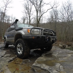
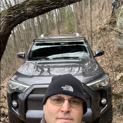
Did this in a stock T4R. Never spun a tire...did use A-Trac a couple times. The biggest issue was ground clearance. I did scrub the front skid a couple of times and bottomed out twice. Other than that no issues. It did rain the night before pretty steady for several hours so the trail was good and wet.
★
★
★
★


A wonderful hike in the Valley and Ridge area of NW Georgia. This hike has it all: uphill, downhill, level stretches, waterfalls and outstanding views. One of my favorites!
★
★
★
★

Decently solid hike nothing difficult for sure. Took me a touch over 3hrs to complete the loop. As far as downed trees I crossed literally one.. not sure what that other review was about. I would however definitely break out the mid sole or actual boots. Can’t tell you how many times I almost rolled an ankle in regular trail runners not being able to see the rocks with all the leafs.
★
★
★
★
★

First time on this..almost missed the left turn to take Freeman Trail towards Flat Rock-Byron Rees. Good Hike!
★
★
★
★
★


The road is overgrown. And there’s a gate on the peidmont side that might be closed
★
★
★

This trail was awesome in a lot of ways! Crazy good steep right at the beginning to get the heart pumping.. ridge line running quick up and downs.. some blown out mud avalanche section to circumnavigate,, followed by people, lots of them! On top and a museum too. Great day. Was quick
★
★
★
★

Great creek crossings. It was up to doors at a coupleof place in mid Aug.
★
★
★
★

Extremly difficult single track at the end of the SErvice road. Ended up at the river with no way to cross. Avoid!
★
Nice easy 4x4 road. Need some clearance, primarily for the creek crossings.
★
★
★
★
★

Very challenging trail . But very rewarding will try to go the loop once I’m in cardio shape
★
★
★
★
★

Fun up and down ride from Hale Ridge to Overflow Rd. And back. no grades too hard.
★
★
★
 stars
stars
Panther Creek Trail is closed as of November 2020. Recent storms washed away bridges and caused significant erosion along exposed trail.
No known reopening date has been scheduled.
Updated 12/28/2020
★
★
★
★
★

Great drive on and around tray mountain. Was surprised to find the trail for dicks creek was closed.
★
★
★
★

Beautiful part of the traverse. A couple of mid-depth water crossings and an awesome waterfall
★
★
★
★
★


Starting from Hwy 76 and heading south on the AT, be prepared for extreme elevation ground with few level hiking areas for the first 3 miles. There is a vista with a great view of Lake Burton on the east side of the trail and it is a very short side trail to arrive at the view. Return hike was much easier as it was descending about 1200’ in elevation.
★
★
★
★


Pretty hike, fern-covered Forest ground leading up to beautiful vista. Part of the AT, going south.
★
★
★
★

Was a back in and out hike, highest elevation was start of the hike so a steep climb out at the end of the hike. There were numerous water crossing, the ones I noted as deep topped my boots. There is a spectacular waterfall about half way through.
★
★
★
★

This off shoot was a really interesting down-and-back. There was a combination of rock-filled roads, some washed out areas, a few manageable muddy spots, tight turns, and a decent view at a few points. I enjoyed this mostly for the moderate technical rating. Though I was able to complete this in my fairly stock LR4 with road tires, I was constantly engaged by the changing terrain. Nice loop/campsite at the end. Took about 30 or so minutes to drive each way.
★
★
★
★
This hike is another one used mostly by locals. From the Pinhoti trailhead you descend 1 mile to West Dug Gap Rd and reverse your trace back to the trailhead. From there you continue your climb to the top of Dug Mtn. and continue southward on the Pinhoti. A mostly solitary (and lovely) hike!
★
★
★
★
★

Great trails for humans and horses. Trails nearest river can flood out and other low lying trails can be swampy. Moderate difficulty. Roads well maintained and trails have some overgrowth.
★
★
★
★

Moderate hike over the ridge of the mountain to a little waterfall
★
★
★
★
While driving to the starting point, you will have to cross a small stream that gutted the road. Not recommended for low-level cars or low-ground clearance vehicles. There is limited parking, but no fees. The decent was easy. The main issue is one of the bridges was knocked out. You can take off your shoes and cross the large creek, or balance on a log to cross it. Keep trekking for another 1/2 mile and you’ll come to a split trail. Take the left trail to view a small waterfall. Go straight for another 1/3 mile and view a large, beautiful waterfall. There is a worn path to access the water near the base of the platform. We used it to filter and refill our canteens for the hike back up the mountain. Our 4yo daughter made the trip (last 1/4 of the hike was moans and groans). 4-stars for trying to figure out how to cross the large creek with a 4yo without getting anything wet.
★
★
★
★
It was $4.00 to park in the area (to help with maintaining the area, but on the honor system really). The hike going down was easy enough for our 4yo daughter. The hike back up she became tired and we carried her the rest of the way. The start of the hike descended down into the valley. Once at the bottom of the trail, there was a boardwalk with some quasi-benches to sit on. We had lunch by the waterfall, but there was no way to be part of the waterfall like some of the other places. The area was fenced off and they had signs stating traveling off the path would result in fines. The view of the split waterfalls were spectacular.
★
★
★
★
★

Great hike! The elevation isn't too bad but still gives you a good workout. The view at Owen's Overlook is fantastic and Springer is as satisfying as ever! Heavy crowds on the AT between Springer and the Springer Parking area but otherwise not many people.
★
★
★
★

Nice hike. Fist time on at. Go before sunrise. Summit at sunrise
★
★
★
★
★

This is a back way into the Georgia travers via GA64 towards Conasauga Lake. It’s a very easy route with a lot spectacular views, waterfalls and it even has the mystical cell phone service in several spots.
★
★
★
★
★
Nice in/out 10 mile hike
Lots of downfall on the trail
Camp Site at CDG is marginal, too much slope for me
Spring water at the camp site - excellent
★
★
★

This trail is the kind of regular trail, but it seems popular because we saw lots of people were hiking.
★
★
★
★
★

Rode with Steve, Damon, Dave and Chuck. Great ride. Some good challenges but wasn’t on the struggle bus the whole ride.
★
★
★
★
★
Have d as fuck ride with rod and chuck. I did a track but can’t really say many of these were actually trails. Not my kind of ride.
★
★
★

Great hike under the rhododendrons, and spectacular views at the top.
★
★
★
★
★
Perfect day for hike!!! A little chilly in the shade though. Jarrard Gap to Blood, then returned on Slaughter Creek trail.
★
★
★
★
Coming in from the South, the ride on the Forest Service Roads is very long. The trail is gorgeous, easy terrain, and very well maintained. We’re in drought, so the waterfall wasn’t flowing hard, but the Hickory Flatts Cemetery was more than enough to make up for it!
★
★
★
★
★

Short and sweet, drive to the top and park. Start out clockwise going down the Pihoti trail to an observation Deck at the waterfalls where it splits off. Loop back around the ridge and walk across the spine of mountain.
★
★
★
 stars
stars
Hike this trail about 20 times per year. Each season brings a different challenge and new features. In early and mid-summer the rhododendron blooms are abundant along the entire trail. Fall colors are amazing and the lack of foliage in the winter opens up new views, but can get quite windy especially along ridges. The views at the top are always amazing...we love to hike up to watch the sunset over the North Georgia mountains and blue ridge.
While this trail is not overly challenging, it is fairly steep with a few different rock scrambles that are tough, but fun.
Get there before 7am on weekends if you want to find parking!
★
★
★
★
★
The trail is really grown up to the point that parts of the trail were almost completely covered. Should be a good hike for late fall.
★
★
★


Beautiful fields and views. Nicely groomed trail. Wide enough for mountain biking. Large incline to summit. Bring water. Hiked with Kristy Anderson from their Lake Blue Ridge House. Quito picked us up on last mile.
★
★
★
★
★
This was my first water-fording experience with my new Jeep. Had a blast and will definitely be back in the future to grab one of the camp spots.
★
★
★
★

Very nice leisurely hike for my wife and I. But, their views from Hogpen Gap are spectacular! On a clear day like this one, you can see Brasstown bald several miles away.
★
★
★
★


Most intense section of Part 3 2019.
Best to go from west to east. Downhill for the worst of it.
Large Rocks, Deep Ruts and Mud Pits, Steep Drops.
★
★
★
★
★


I tracked this hike from the top down only. From the bottom, the first hill up to the ridge is all switchbacks so it moderates the impact of the elevation gain. Once up on the ridge it is beautiful. Feb 2018. There is a quarter mike section of a lot of rhody blowdowns and one large red oak to navigate around. Leftover from the December ice storm. I really enjoyed the views along the ridge. Views from the top of course are amazing.
★
★
★
★
★

 stars
stars