United States
›
California
›
Sequoia National Park
›
High Sierra Trail
Search
Search
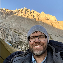
High Sierra Trail
(
)
based on
31
tracks & routes
|
|
DIFFICULT
#142
hike out of 210 in
Sequoia National Park
|
DIFFICULT
View Photos (50)
fullscreen
link
Copy Link
email
Email
directions
Driving Directions
file_download
GPX/KML
GPX
KML
13.9
mi
Distance
7
hrs
49
min
Time
terrain
2,611
ft
Elev Gain
Public Tracks
HeartyJuniper8970
4 years, 8 months ago
Track (8/19/20, 06:58:42)
HardKnoll9206
4 years, 8 months ago
Track (8/6/20, 7:20:28AM)
WiseBinos6569
4 years, 8 months ago
Track (8/6/20, 7:20:27AM)
Diego Rodriguez
4 years, 10 months ago
Moraine Lake => Junction Meadow
Janie Hitchcock
5 years, 8 months ago
Track (8/26/19, 8:04:01AM)
SassyElm5506
5 years, 8 months ago
Day Three
yLy9Q3Rs
5 years, 8 months ago
HST Day 4: Moraine Lake to Junction Meadow (8/22/19, 08:30:22)
Elevation Profile
0
2
4
6
8
10
12
14
7.0k
8.0k
9.0k
Seasonal Popularity
Jan
Feb
Mar
Apr
May
Jun
Jul
Aug
Sep
Oct
Nov
Dec
0k
0.005k
0.01k
0.015k
Nearby Hiking Trails
Kennedy Meadows Campground via Pacific Crest Trail
★
★
★
★
★
DIFFICULT
111.8
mi
High Sierra Trail
★
★
★
★
★
DIFFICULT
67.3
mi
Onion Valley to MT Summit
★
★
★
★
★
DIFFICULT
46.5
mi
HST- High Sierra Trail
★
★
★
★
★
DIFFICULT
55.5
mi
North Sawtooth Peak via Franklin Pass Trail and Sawtooth Pass Trail
★
★
★
DIFFICULT
27.2
mi
Fires Prohibited Loop via Mineral King Road
★
★
★
★
★
DIFFICULT
36.9
mi
Wilderness campground Loop via Sawtooth Pass Trail and Lost Canyon Trail
★
★
★
★
★
DIFFICULT
28.2
mi
Mount Whitney via Pacific Crest National Scenic Trail #2000
★
★
★
DIFFICULT
28.1
mi
Mount Whitney via John Muir Trail and Pacific Crest Trail
★
★
★
★
DIFFICULT
78.0
mi
Mount Whitney via John Muir Trail
★
★
★
★
DIFFICULT
201.4
mi