United States
›
South Carolina
›
Table Rock State Park
›
Table rock view point
Search
Search
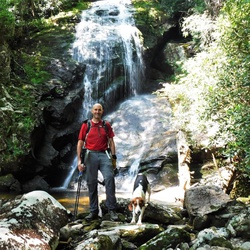
Table rock view point
(
)
★
★
★
★
★
based on
4
tracks & routes
|
|
EASY
#10
hike out of 11 in
Table Rock State Park
|
EASY
fullscreen
link
Copy Link
email
Email
directions
Driving Directions
file_download
GPX/KML
GPX
KML
1.4
mi
Distance
30
min
Time
terrain
1,332
ft
Elev Gain
Public Tracks
GlowCloud4467
8 months ago
The Stool, Rock Climbing Trail and Overlook
stars
Jerry Ellsworth
2 years ago
FTC-The Stool-Apr2023
TinySequoia6905
2 years ago
Stool Mountain
LittleBasin4450
2 years, 1 month ago
The Stool, Table Rick SP
CrispWetland4786
4 years ago
Table rock bushwhacking
Elevation Profile
0
0.20
0.40
0.60
0.80
1
1.20
1.40
1.5k
2.0k
2.5k
Seasonal Popularity
Jan
Feb
Mar
Apr
May
Jun
Jul
Aug
Sep
Oct
Nov
Dec
0k
0.002k
0.004k
0.006k
Nearby Hiking Trails
Table Rock Trail to the Summit
★
★
★
★
★
MODERATE
6.9
mi
Pinnacle Mountain - Table Rock Loop, in Table Rock State Park, SC
★
★
★
★
★
DIFFICULT
10.7
mi
Green Creek Falls Loop via Pinnacle Mountain Trail and Carrick Creek Loop
★
★
★
★
★
EASY
1.8
mi
Pinnacle Mountain Loop
★
★
★
★
★
MODERATE
7.7
mi
Table Rock State Park to Sassafras Mtn via Foothills Trail (Round Trip)
★
★
★
★
★
DIFFICULT
18.5
mi
Sassafras viewpoint via Foothills Trail
★
★
★
★
★
DIFFICULT
8.3
mi
Sassafras Mountain via Foothills Trail and Gum Gap Trail
★
★
★
★
★
DIFFICULT
13.6
mi
Halfway Shelter via Table Rock Trail
★
★
★
★
MODERATE
3.9
mi
Middle Rachael Creek Falls via Alewine Road and Big Bottom Road
★
★
★
★
EASY
2.9
mi
Dolves Mountain via Foothills Trail
★
★
★
★
DIFFICULT
14.0
mi

 stars
stars