meta

Sherrard Point Loop via Multnomah Creek Way #444

based on 71 tracks & routes
#1 hike out of 13 in
emailEmail directions Driving Directions
6.4 mi
Distance
3 hrs 26 min
Time
terrain
1,109 ft
Elev Gain


Public Tracks

user_profile
Baker 8 years, 8 months ago
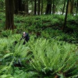
Larch Mountain Loop, Columbia River Gorge National Scenic Area
Great hike! Not many people on the trail. Higher up in elevation, so was a little cooler. I've been here in the winter and you can't drive to the top as the gate is closed due to snow. There are alternate routes you can do too. Check local guide books.
user_profile stars
Sugar Pine 5 years, 6 months ago
Larch Crater
Hike with Jean and Lori. Many hedgehogs along the north side, but many belly button small ones. Water flowing down trail also in north area near creek. Trail rocky and not well drained.
user_profile
Jon Ellinger 8 years, 2 months ago
Larch Mountain
Oct 19, 2014 1:41 pm
user_profile
alexdurkee 4 years, 5 months ago
user_profile
joncrogers 5 years, 4 months ago
user_profile
Kathleene 5 years, 5 months ago
user_profile
vuylstek 5 years, 6 months ago
user_profile
charliemeye 5 years, 6 months ago
user_profile
da.wiley1 5 years, 6 months ago
user_profile
rangnath 5 years, 7 months ago
user_profile
Becky 5 years, 7 months ago
user_profile
da.wiley1 5 years, 7 months ago
user_profile
djathens 5 years, 8 months ago
user_profile
scarples 5 years, 9 months ago
user_profile
SnakeDog 7 years, 7 months ago
user_profile
mike 9 years, 10 months ago