Rincon Peak
Overview
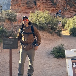
This is a difficult one way trail to Rincon Peak in Saguaro National Park (East) - Rincon Mountain District.
Plan on the better part of a day out and back. It is a steep and unrelenting climb. The last half mile below the summit is especially challenging due to severe steeps and boulders to crawl over/around. The 360 views are worth the expenditure of energy. All of southeastern Arizona and beyond are in view. Plan to spend some time on the summit.
Getting Started
Exit Mescal Rd from Interstate 10 and head north to the Miller Creek Trail Head. High clearance vehicle is recommended. Plan a day to hike up Miller Creek Trail to the Happy Valley Campground. Get a camping permit from the NPS. Take the next day to climb the Rincon Peak Trail found just by the campground. Water should be available on the mountain, but no guarantees.
Rate this Hike
★★★★★

Public Tracks
There are no published trips for this hike. There are 16 private trips.
Record a track in Gaia GPS on iOS or Android and publish it to have it show up here.