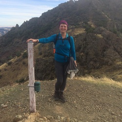
United States
›
California
›
Sierra Azul Open Space Preserve
›
Mount Umunhum Trail (from Bald Mountain parking)
Search
Search
Mount Umunhum Trail (from Bald Mountain parking)
(
)
★
★
★
★
★
based on
135
tracks & routes
|
|
MODERATE
#3
hike out of 21 in
Sierra Azul Open Space Preserve
|
MODERATE
View Photos (19)
fullscreen
link
Copy Link
email
Email
directions
Driving Directions
file_download
GPX/KML
GPX
KML
8.0
mi
Distance
3
hrs
48
min
Time
terrain
1,164
ft
Elev Gain
Sights to See
Guadalupe Creek Overlook
Public Tracks
katie_shaffer
4 years, 5 months ago
Mount Umunhum Road to Mount Umunhum Trail, Santa Clara County, CA, USA
Chuck
1 month, 1 week ago
Saturday Lunch Activity
cdhaliwal
2 months ago
Bald mountain parking to Umunhum
j.tobias.smith
3 months, 2 weeks ago
Mt. Um
beanie.zhang
4 months ago
Sunday Lunch Hiking
maxtor.chen
4 months ago
Sunday Lunch Hiking
smarabondo
4 months, 1 week ago
Mount Umunhum Summit
wn0929
4 months, 1 week ago
Sunday Morning Activity
ptfleischman
4 months, 2 weeks ago
Sunday Morning Activity
jim
1 year, 4 months ago
Mt Umuum
cfeetham
3 years, 1 month ago
Umunhum 2-16-22
klsmith1953
3 years, 8 months ago
Track (7/12/21, 1:34:47PM)
stars
Jacob
3 years, 9 months ago
Mount Umunhum from Bald Mountain Out & Back
Lluis
3 years, 10 months ago
Mt. Omunhum (5/21/21, 1:23:59PM)
darien.niamir
3 years, 11 months ago
Mt. Umunhum
marcin
4 years ago
Mt. Umunhum
jennkeohane
4 years, 3 months ago
BART Mt Umunhum
Ken Toyama
4 years, 3 months ago
2020.12.05 Mt. Umunhum
vibarraltgov14
4 years, 4 months ago
Mount Umunhum
bruceawilson
4 years, 4 months ago
Track (11/13/20, 8:51:07AM)
stephenrhee
4 years, 10 months ago
Track (5/16/20, 3:12:04PM)
mtom.margolis
4 years, 11 months ago
Track (4/3/20, 12:40:48)
grognd
5 years, 5 months ago
Mount Umunhum Trail , Santa Clara County, CA, USA
xtj
5 years, 5 months ago
Mount Umunhum (September 29, 2019)
pattyp38
5 years, 6 months ago
Track (9/23/19, 9:01:28AM)
deac
5 years, 6 months ago
Track (9/19/19, 3:18:56PM)
grognd
5 years, 7 months ago
Mt. Umunhum #TrailPatrol
stars
SF Bay Area
5 years, 9 months ago
Mt. Umunhum with BAHAAF 6/9/19 07:53:43
Reid
5 years, 10 months ago
Mt Umunhum
sirus6
6 years ago
Mt. Umunhum
stars
Allenb
6 years, 2 months ago
Mount Umunhum Trail – 2019-01-18
Jeff
6 years, 6 months ago
Track (9/17/18, 10:44:19AM)
donnabauer
6 years, 9 months ago
Track (6/2/18, 9:50:13AM)
grognd
6 years, 9 months ago
My Umunhum Trail - Bald Mtn Lot to Summit - Sierra Azul OSP
kevin.maitski
6 years, 10 months ago
Mt. Umunhum
stars
SF Bay Area
6 years, 11 months ago
Mt. Umunhum with Megan 4/8/18 12:23:24
sanjosedave
7 years ago
Track (3/4/18, 1:19:19PM)
SoCalHiker
7 years, 2 months ago
Mt Umunhum (1/22/18, 11:07:20AM)
dearallen
7 years, 4 months ago
Mt. Umunhum Road, Santa Clara County, CA, USA
Wrigley
7 years, 4 months ago
Mt. Umunhum
stars
SF Bay Area
7 years, 6 months ago
Mt. Umunhum! 9/23/17 16:33:44
billandlisa2
7 years, 6 months ago
Track (9/20/17, 8:43:21AM)
Elevation Profile
0
1
2
3
4
5
6
7
8
2.5k
3.0k
Seasonal Popularity
Jan
Feb
Mar
Apr
May
Jun
Jul
Aug
Sep
Oct
Nov
Dec
0k
0.02k
0.04k
Nearby Hiking Trails
Saint Josephs Hill Loop via Priest Rock Trail
★
★
★
★
★
MODERATE
7.6
mi
Kennedy Trail from Kennedy Lane in Los Gatos to Lime Kiln Trailhead and back
★
★
★
★
★
DIFFICULT
10.8
mi
Church Hill Loop via Randol Trail
★
★
★
★
★
EASY
3.5
mi
Los Gatos to Almaden Quicksilver
★
★
★
★
★
DIFFICULT
20.4
mi
Mount Umunhum Summit from Hicks Road
★
★
★
★
DIFFICULT
16.2
mi
Guadalupe Dam Loop via New Almaden Trail
★
★
★
★
★
DIFFICULT
14.6
mi
Saint Josephs Hill Loop via Kennedy Trail
★
★
★
★
DIFFICULT
19.6
mi
Church Hill Loop via Randol Trail
★
★
★
★
★
EASY
4.2
mi
Mine Hill Trail and Randol Trail Loop
★
★
★
★
★
DIFFICULT
11.2
mi
Yerba Buena Group site via Coyote Creek Trail
★
★
★
DIFFICULT
18.3
mi