8.3 mi
Distance
4 hrs 14 min
Time
terrain
1,703 ft
Elev Gain
Public Tracks

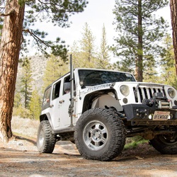
Lower Lytle Creek Ridge (Off road - Easy)
Lower Lytle Creek Ridge is an all fire access road trail that is easily accessible by any stock 4x4. It runs from the Glen Helen area to the town of Lylte Creek with some nice vistas of the valley below. There is nothing too technical other the a few minor ruts. This is solid trail for those new to off roading looking to get a feel for their rigs.

Lower Lytle Creek Divide
Forest Service Road Number = 3N31<br>Name = Lower Lytle Creek Divide<br>Beginning Mile Post = 0<br>Ending Mile Post = 8.05<br>