Avery Lean-to Loop via Appalachian Trail and Fire Wardens Trail
15.6 mi
Distance
7 hrs 26 min
Time
terrain
2,834 ft
Elev Gain
Overview
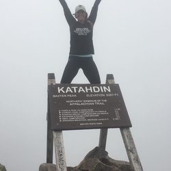
This is a difficult loop trail to Avery Lean-to in Bigelow Preserve.
This trail also goes by South Peak, The Horns, North Peak, and The Horns Pond.
Sights to See
Rate this Hike
★★★★★