United States
›
Washington
›
Mount Rainier National Park
›
Mount Ararat via Kautz Creek Trail
Search
Search
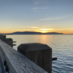
Mount Ararat via Kautz Creek Trail
(
)
based on
133
tracks & routes
|
|
DIFFICULT
#10
hike out of 275 in
Mount Rainier National Park
|
DIFFICULT
View Photos (36)
fullscreen
link
Copy Link
email
Email
directions
Driving Directions
file_download
GPX/KML
GPX
KML
11.0
mi
Distance
5
hrs
15
min
Time
terrain
3,205
ft
Elev Gain
Public Tracks
ThickAurora7524
6 months, 3 weeks ago
Kautz creek trail
YoungMist6143
1 year, 9 months ago
Krause Creek 2 Indian Henry Ranger Cabin
FreshHeather6541
4 years, 8 months ago
Indian Henry’s
LightBrook9821
5 years, 7 months ago
Track (9/27/19, 9:15:59AM)
HappyValley9590
5 years, 7 months ago
Kautz Creek Trail
Bill
5 years, 8 months ago
Indian Henry
shane ballweg
5 years, 9 months ago
Track (7/9/19, 10:36:02AM)
Jrob235
5 years, 10 months ago
Mount Ararat
Troy Mason
6 years, 7 months ago
Kautz Creek to Indian Henry’s
EarlyFern9773
7 years, 8 months ago
Kautz Creek Trail (8/4/17, 10:06:09AM)
lcd32bit
8 years, 3 months ago
Kautz Creek to Indian Henry's Hunting Ground
RichQuarry6555
8 years, 4 months ago
Mount Ararat (12/17/16, 7:43:54AM)
Brian Kennan
8 years, 5 months ago
Mount Ararat #1
StrongRainbow5524
9 years, 5 months ago
Copper/trail
StrongRainbow5524
9 years, 5 months ago
Copper/trail
StrongRainbow5524
9 years, 5 months ago
Iron/trail
StrongRainbow5524
9 years, 5 months ago
Iron/trail
StrongRainbow5524
9 years, 5 months ago
Iron/trail
Elevation Profile
0
2
4
6
8
10
3.0k
4.0k
5.0k
Seasonal Popularity
Jan
Feb
Mar
Apr
May
Jun
Jul
Aug
Sep
Oct
Nov
Dec
0k
0.01k
0.02k
0.03k
0.04k
Nearby Hiking Trails
Transportation Exhibit Loop via Rampart Ridge Trail and Wonderland Trail
★
★
★
★
★
EASY
4.9
mi
Chutla Peak Loop via Eagle Peak Trail
★
★
★
★
★
DIFFICULT
7.5
mi
Mystic Lake Loop via SUnrise
★
★
★
★
★
DIFFICULT
87.9
mi
Mirror Lakes via Kautz Creek Trail
★
★
★
★
★
DIFFICULT
12.5
mi
Transportation Exhibit via Wonderland Trail
★
★
★
★
★
MODERATE
5.3
mi
Squaw Lake via Wonderland Trail
★
★
★
★
★
MODERATE
6.2
mi
Longmire Museum via Rampart Ridge Trail
★
★
★
★
★
EASY
3.6
mi
Madcap Falls via Wonderland Trail
★
★
★
★
EASY
2.9
mi
Longmire Museum via Wonderland Trail
★
★
★
★
DIFFICULT
30.0
mi
D042 via Wonderland Trail
★
★
★
MODERATE
5.5
mi