Mount Moosilauke via Beaver Brook Trail
6.5 mi
Distance
2 hrs 44 min
Time
terrain
2,927 ft
Elev Gain
Overview
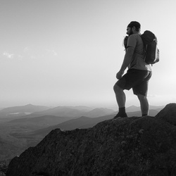
This is a moderate out and back trail to Mount Moosilauke in White Mountain National Forest.
Rate this Hike
★★★★★


Public Tracks

Moosilauke via Beaver Brook
Per Scott's suggestion, we met at Flapjack's at 8am. Well, Jay Bearfield was late and tanked up en route. When we got to the trailhead, the temperature was still warm (late 30s), and other hikers warned us to take snowshoes, which we never used!. Starting at 9:23, we almost immediately took the wrong fork and ended up off the trail, having to cross the brook through deep snow to reach the trail. You can see the deviation on the track. Then it was steep uphill along the Beaver Brook for 2 hours to reach the shelter. Then another 20 minutes to the trail junction. After skirting Mt Blue on a little iffy trail, we climbed the gradual slope up Mt. Moosilauke. The final ascent was out of the trees; we all estimated 30 mph winds. I stayed about 30 s at the summit; the temperature had dropped 10-15 degrees. Coming down was fine until the steep spots on Beaver Brook, where I did a few butt slides. Jay and Scott were always ahead of me. We got back about 3:30. Although the GPS track here says 6.8 miles, the trailhead sign said 7.6 miles RT. Weird. It felt like 8 miles. Beaver Brook is certainly steep. A good hike for me.

Mount Moosilauke via Beaver Brook
http://www.katiewanders.com/2018/03/winter-summit-of-mount-moosilauke-via.html

Benton Hike
https://connect.garmin.com/modern/activity/19643217279


 stars
stars