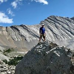
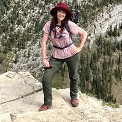
Canada
›
Alberta
›
Kananaskis Country Public Land Use Zone
›
Cox Hill
Search
Search
Cox Hill
(
)
based on
21
tracks & routes
|
|
MODERATE
#14
hike out of 20 in
Kananaskis Country Public Land Use Zone
|
MODERATE
View Photos (17)
fullscreen
link
Copy Link
email
Email
directions
Driving Directions
file_download
GPX/KML
GPX
KML
7.8
mi
Distance
3
hrs
50
min
Time
terrain
2,290
ft
Elev Gain
Public Tracks
gfauland
1 month, 1 week ago
Friday Lunch Activity
jamesinflames0o
2 months, 1 week ago
Cox Hill
ToughGaiters2306
2 months, 1 week ago
Sunday Morning Hiking
Gita Grahame
5 months, 3 weeks ago
Cox Hill
Crystal Marini
5 months, 3 weeks ago
Mt cox
Ron Tucker
2 years, 2 months ago
Cox Hill 2023
FastRappel8275
3 years, 2 months ago
Track (2022-02-13, 9:12:06AM)
Larry Cooper
4 years ago
Cox Hill Ridge (2021-04-09, 9:36:15AM)
Todd Brunner
4 years, 4 months ago
Tom Snow Track (TCT) to Cox Hill Trail (TCT)
LongRedwood7374
5 years, 11 months ago
Cox hill
Mihail
6 years, 4 months ago
Track (2018-12-25, 10:53:37AM)
Jessica Murray
7 years ago
Cox Hill Track (2018-04-14, 10:32:06AM)
Dave Murray
7 years ago
Track (2018-04-14, 10:30:38)
Elevation Profile
0
1
2
3
4
5
6
7
8
5.0k
6.0k
7.0k
Seasonal Popularity
Jan
Feb
Mar
Apr
May
Jun
Jul
Aug
Sep
Oct
Nov
Dec
0k
0.005k
0.01k
Alternate Routes
Cox Hill
★
★
★
★
DIFFICULT
11.7
mi
Nearby Hiking Trails
Ole Buck Loop Loop
★
★
★
★
★
EASY
3.0
mi
Jumpingpound Mountain Loop via Powderface Trail
★
★
★
★
★
DIFFICULT
18.1
mi
Deer Ridge Loop
★
★
★
★
★
EASY
4.5
mi
Powderface Trail
★
★
★
★
★
DIFFICULT
21.9
mi
Jumpingpound Mountain via Cox Hill Trail
★
★
★
DIFFICULT
9.5
mi
Jumpingpound Mountain via Jumpingpound Ridge Tr
★
★
★
★
★
DIFFICULT
8.8
mi
Cox Hill Loop via Powderface Trail
★
★
★
★
★
DIFFICULT
12.8
mi
Eagle Hill
★
★
★
★
EASY
4.5
mi
Deer Ridge Loop
★
★
★
EASY
4.1
mi
Jumpingpound Mountain via Cox Hill Trail
★
★
★
DIFFICULT
10.8
mi