Canada
›
Alberta
›
Cataract Creek Provincial Recreation Area
›
Cataract Creek Loop via Mount Burke North Peak Route
Search
Search
Cataract Creek Loop via Mount Burke North Peak Route
(
)
based on
15
tracks & routes
|
|
DIFFICULT
#24
hike out of 34 in
Cataract Creek Provincial Recreation Area
|
DIFFICULT
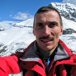
View Photos (4)
fullscreen
link
Copy Link
email
Email
directions
Driving Directions
file_download
GPX/KML
GPX
KML
8.5
mi
Distance
3
hrs
52
min
Time
terrain
2,841
ft
Elev Gain
Public Tracks
Anonymous User
6 years, 11 months ago
Mt. Burke North/Main (2018-05-05, 10:14:44)
Mihail
7 years, 6 months ago
Mount Burke
Elevation Profile
0
2
4
6
8
6.0k
7.0k
8.0k
Seasonal Popularity
Jan
Feb
Mar
Apr
May
Jun
Jul
Aug
Sep
Oct
Nov
Dec
0k
0.005k
0.01k
Nearby Hiking Trails
Mount Burke
★
★
★
★
★
MODERATE
7.8
mi
Raspberry Ridge via Rasberry Lookout Trail
★
★
★
★
★
MODERATE
2.4
mi
Raspberry Ridge Loop via Rasberry South Ridge Trail and Rasberry Lookout Trail
★
★
★
★
MODERATE
6.5
mi
Mount Burke Loop
★
★
★
★
DIFFICULT
7.4
mi
Etherington-Baril Ridge Loop
★
★
★
★
EASY
4.0
mi
Hailstone Butte via Sentinel Peak Trail
★
★
★
DIFFICULT
10.9
mi
Etherington Cr via Forestry Trunk Road
★
★
DIFFICULT
62.1
mi