Panorama Point Loop via Skyline Trail
Overview
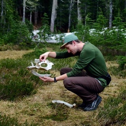
This is a moderate-difficult loop trail to Panorama Point in Mount Rainier National Park. Also known as Skyline Loop trail. This roughly 5.5 mile loop trail begins and ends with continuous amazing views of Mount Rainier, Mount Adams, Mount St. Helens and the Cascades. Take in the beautiful mountain foliage, flowers, fresh air. The first 1/2 mile is steep, but push on. Follow the trail up (you pass junctions for Glacier Basin and Dead Horse Creek - save for another hike!) and continue up the stone stair case. This area gives a great photo spot for Mount Rainier. Once at Panorama Point take a seat and pull out your snacks and just admire the views of the mountains around you. Be careful of the squirrels, they'll take the food right out of your hand or steal from you bags. Harmless creatures, but don't encourage their behavior. Panorama Point offers the most unique pit toilet, I encourage you to at least step inside! The trail begins it's downward loop after this with a few gains along the way. You'll come across a few waterfalls along the way and wildflowers patches.
Hiking clockwise gets the brunt of the gain out of the way first, whereas hiking counterclockwise is a more gradual gain.
This trail goes by Myrtle Falls Viewpoint, Myrtle Falls, Sluiskin Falls, and Glacier Vista.
Getting Started
National Park Pass required. Paradise can get very busy in the summer (any day of the week) and busy on the weekends during the rest of the year. It is recommended to start early in the day to avoid crowds and ensure parking. Bathrooms available at the parking lot as well as a visitor's center.
Taking Children
Moderate-difficult hike, I recommend taking the counterclockwise route if having children hike along with you.
Sights to See
Rate this Hike
★★★★★


Public Tracks


 stars
stars