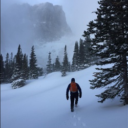
Teocalli Ridge Trail 557 and West Brush Creek Road 738.2A
10.8 mi
Distance
5 hrs 33 min
Time
terrain
2,148 ft
Elev Gain
Overview
This is a difficult one way trail in Gunnison National Forest.
Sights to See
Rate this Hike
★★★★★
Public Tracks

Brush Creek Ride
https://connect.garmin.com/modern/activity/20007777458